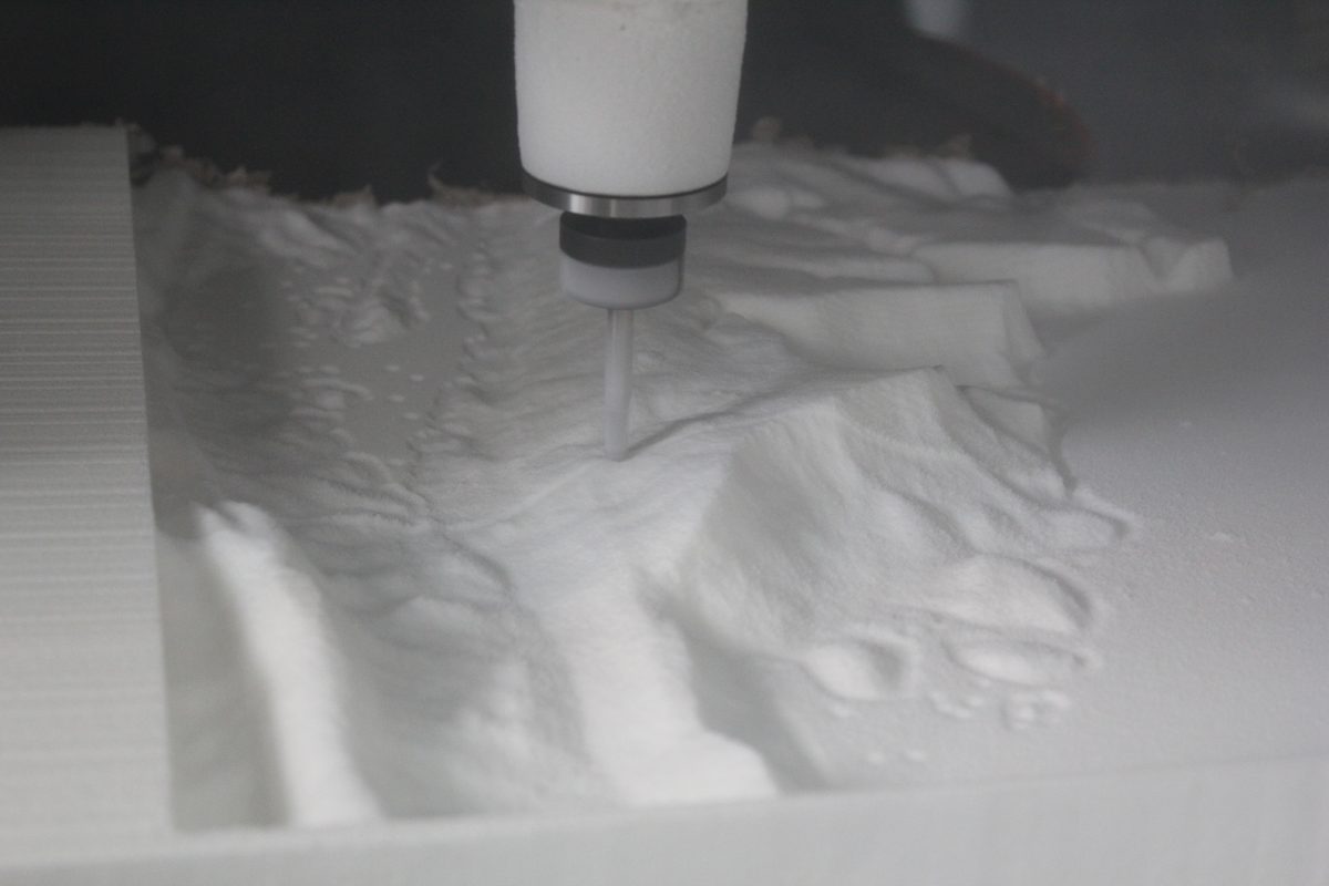
May 2014 | Progress on the 3D Map of the Jurassic Coast
We used a CNC (Computer Numerically Controlled) milling machine to build the 3D Map from geospatial data of the Jurassic Coast supplied by Dr Andy Ford of Bournemouth University. By starting with a solid block and removing material, the Subtractive Rapid Prototyping...
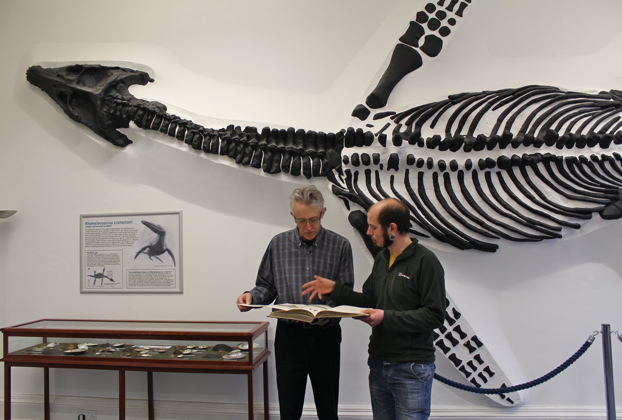
April 2014 | Researching Fossils at BRLSI in Bath with Dr Matt Williams for Jurassic Coast Paintings
Jeremy and Dr Matt Williams looking at volume IV of A History of British Fossil Reptiles, by Sir Richard Owen, 1849. Jeremy visited Bath Royal Literary and Scientific Institution to collect images of fossils from Sir Richard Owen's: A History of British Fossil...
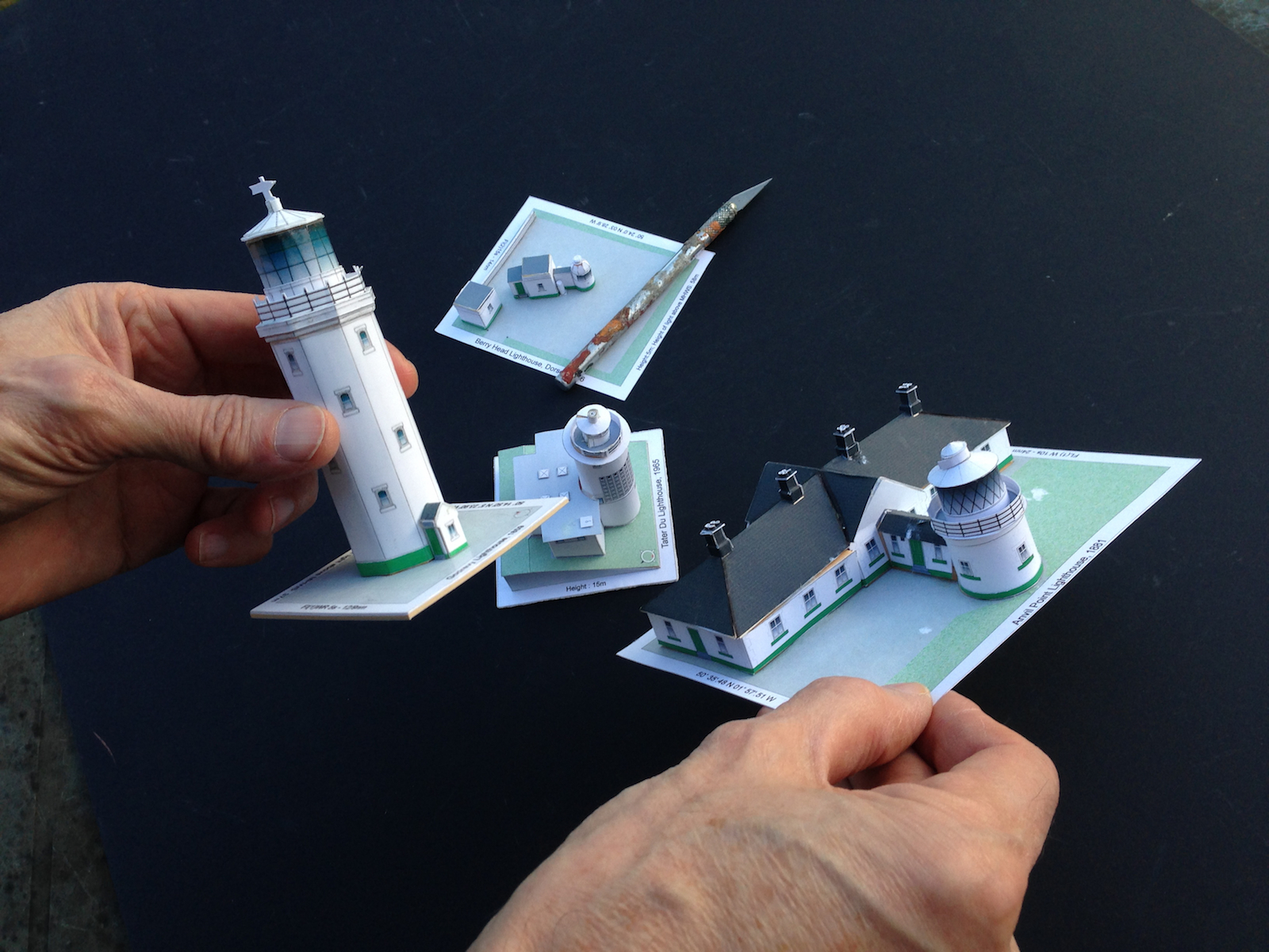
March 2014 | Scale Models of Lighthouses
A series of scale models of lighthouses in the South West were constructed, for studio reference. Jeremy holds the models for 'Godrevy Lighthouse, St Ives' on his left hand and 'Anvil Point Lighthouse, Dorset' on his right hand; in the background you can see 'Tater Du...
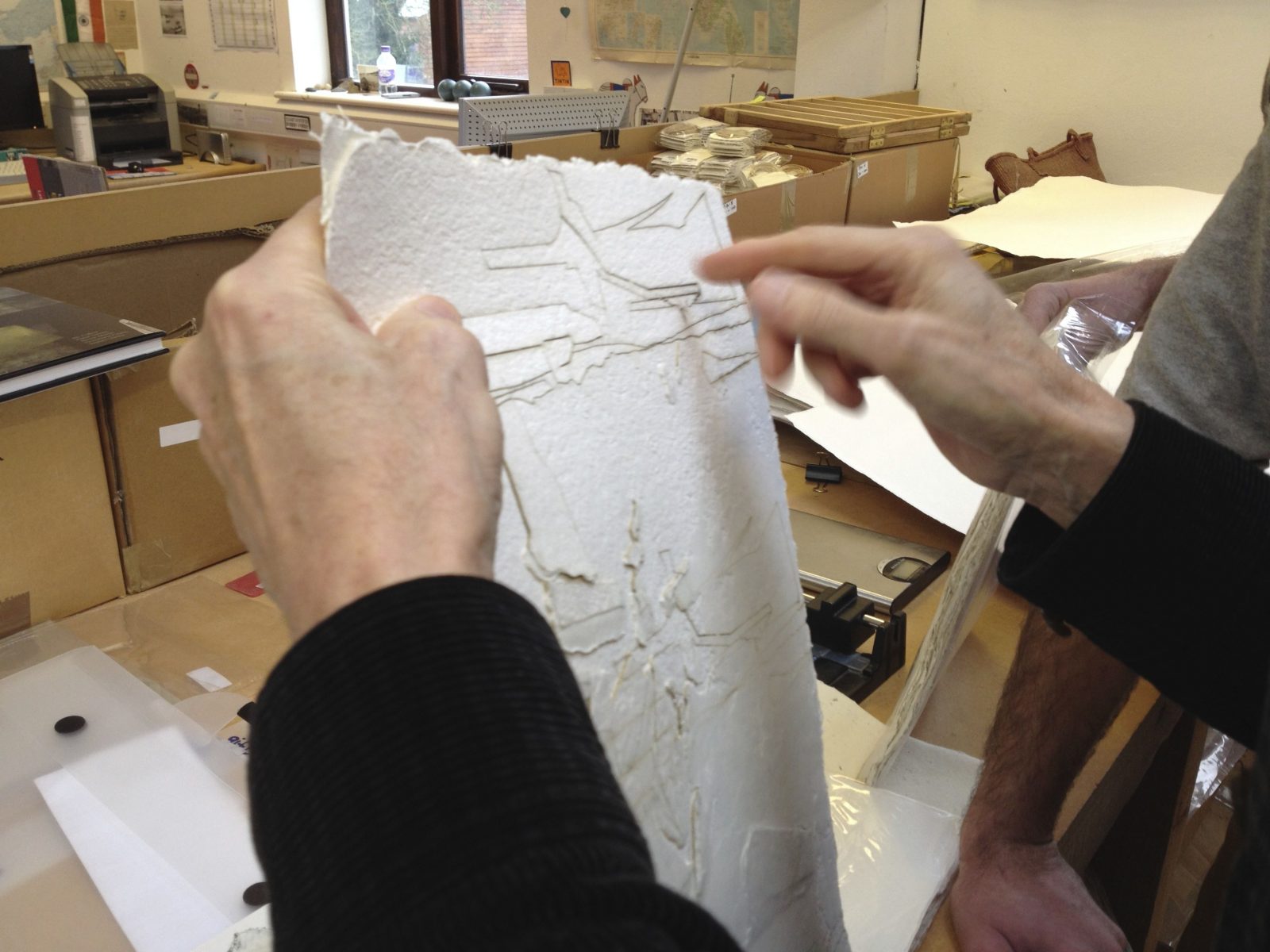
February 2014 | Visiting Khadi Papers in Chilgrove, Chichester
The paper is made in South India with off-cuts from cotton T-shirts, which arrive in massive jute sacks from hosiery mills. As well as using recycled cotton, Khadi Papers are also made from recycled jute and from tropical crop residual fibres, banana leaf and sugar...
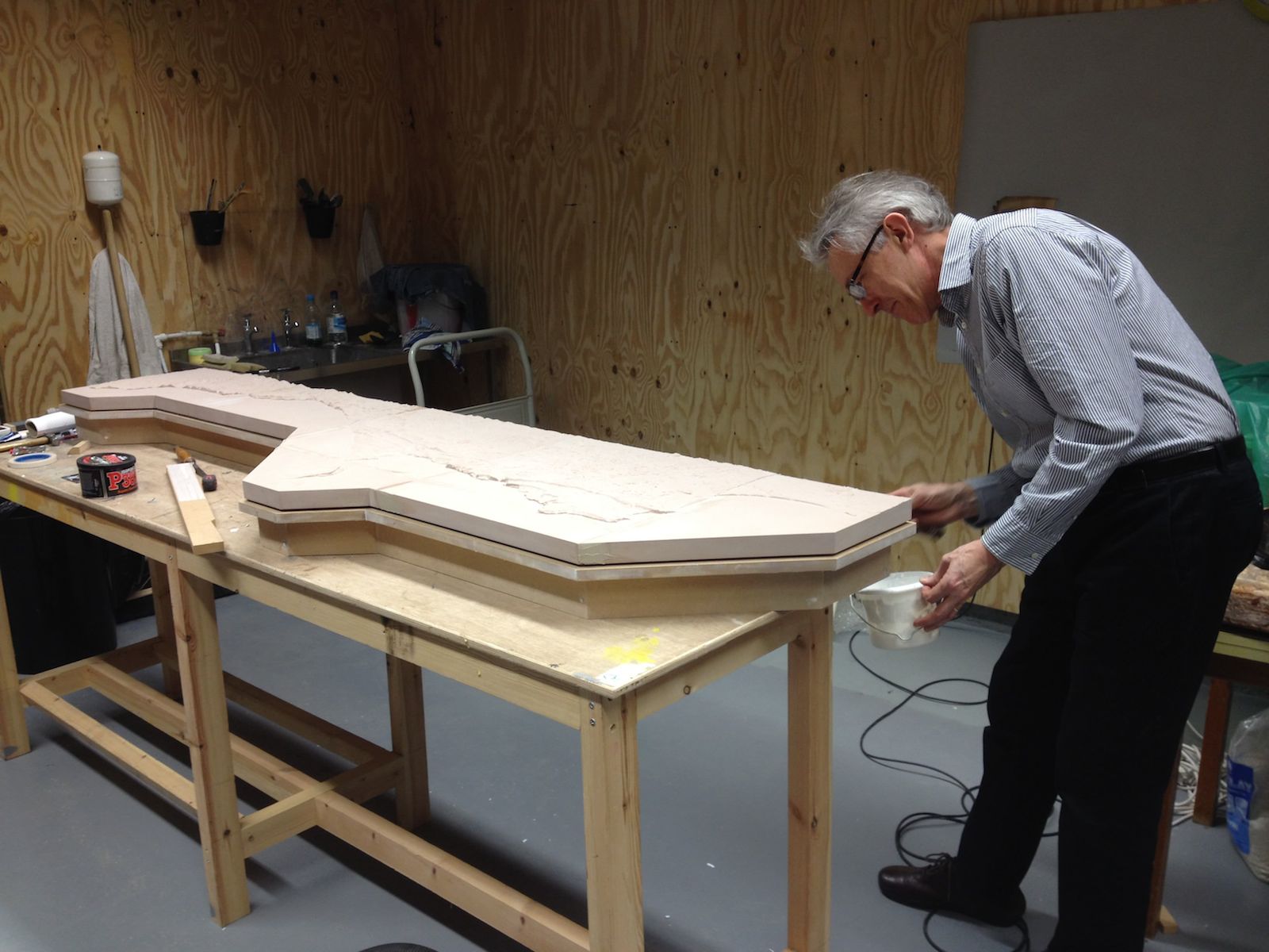
January 2014 | Milling a Relief Map of the Dorset Coast
Jeremy is building a large scale 3D model of the Dorset Coast with data supplied by Andrew Ford of Bournemouth University. The map is being carved from high density modelling board on a Roland milling machine by Jake Durrant at Ravensbourne. ...
December 2013 | Jeremy Visits Guangzhou Academy, China
Jeremy gave a presentation at Guangzhou Academy of Fine Arts in China. He met with Staff and students who were celebrating the 60th Anniversary of the Academy. Jeremy Gardiner's name written in Chinese, on the cover of his monograph
October 2013 | Unfolding Landscape Talk | Bath Royal Literary and Scientific Institution, Bath
Jeremy Gardiner spoke at BRLSI, to a full auditorium of artists and academics, about his artistic excavation of the geology of landscape, how it is shaped by human activity and the forces of nature. Aware of distinct geologies, Gardiner interprets through his painting...

September 2013 | Sea Kayaking at Handfast Point | Jesse Lawrence Filming ‘A Page in the Book of Time’
Old Harry lies at the end of a chalk headland that sticks out to sea and is part of the Purbeck Monocline that gives rise to the prominent ridge of steeply dipping Cretaceous chalk which now forms the Purbeck Hills. This chalk band runs from Swyre Head via Flower's...

August 2013 | Visit to Lundy Island on a Recce
Lundy South lighthouse stands at the south-east corner of the island and its flashing white light is visible for 15 miles. The first light was a petroleum vapour burner, but was converted to electricity in 1971. When modernised in 1994, the station was automated and...

July 2013 | Belgrave Gallery, St Ives | Cornish Monoprints
Summer Show Belgrave Gallery, St Ives • 15 July to 31 August, 2013 Monoprints of Cornish landscapes including Porthtowan, Sennen Cove, Levant Cliffs and St Michael's Mount; featuring the Cornish launch of the book 'The Art of Jeremy Gardiner, Unfolding Landscape'...
February 2013 | Lecture on The Geology of Landscape | RWA, Bristol
UNFOLDING LANDSCAPE - Saturday 9 February - 11am - RWA at Queen's Road, Clifton, Bristol BS8 1PX February Snow, Lulworth Cove, Dorset60cm x 120cm Jeremy Gardiner spoke about his artistic excavation of the geology of landscape, how it is shaped by human activity and...

January 2013 | London Art Fair | Monograph
'Unfolding Landscape' Artist Jeremy Gardiner in conversation with Pallant House curator Simon Martin at the London Art Fair - Friday 18 January - 12:30 to 1:30pm Pallant House curator Simon Martin spoke with British artist Jeremy Gardiner (b. 1957) about his...